|
Grand Rapids Maps |
 |
|
|
|
Grand Rapids Maps |
|
|
|
|
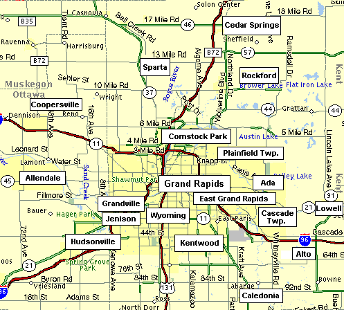
www.mapquest.com
Grand Rapids/Kent County is divided into 4 quadrants:
NW, NE, SW, SE.
|
|
|
| Ó 2002-2010 Vantage Point Real Estate, LLC. All Rights Reserved. |
| This website, including but not limited to: text, layout, and design is copyrighted |
| and not to be copied or reproduced without the expressed permission of Robert Young. |
| Violators will be prosecuted to the full extent of the law. |
| Disclaimer |
|
|